- Islandora Repository
- Archives and Manuscripts Collections
- Stephen F. Austin map collection
-

-
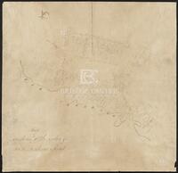
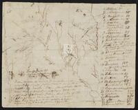
Actual work to Correct the Maps by Cronkrite
-
Sketch of plats along the upper Tres Palacios Creek in Matagorda and Waller Counties. 32 x 40.2 cms. On verso: Actual work to correct the maps by Cronkite., Stephen F. Austin map collection, 2AA1, SA 27, 1824?, Texas History, Cartography
-

-
The Bingamen Bottom Place
-
Sketch of survey of Bingamen Bottom Place in Wythe County, Virginia. 25 x 24 cms. In colored outline., Stephen F. Austin map collection, 2AA1, SA 2, 1791?, Cartography
-

-
Caldwell Survey
-
Sketch of survey of Cedar Lake and Bernard showing J.P. Caldwell's survey. 30 x 36 cms., Stephen F. Austin map collection, 2AA1, SA 104, 1831?, Texas History, Cartography
-

-
Capt. Adams Draft of the Coasts and Bay, Corpus Christy, 1827
-
Draft of the Coasts and Bay, Corpus Christy. This map was found by a patron in a different collection and is believed to be a map from the Stephen F. Austin Collection. 32 x 30 cms. On verso: "Capt. Adams Draft of the Coast and Bay, Corpus Christy, 1827" inscription., Stephen F. Austin map collection, 2AA1, SA 121, 1827?, Texas History, Cartography
-

-
Cedar Lake Survey
-
Survey of Cedar Lake area including timberland and marshland or wet prairie. 35 x 20 cms. On verso: "Cedar Lake Survey" inscription., Stephen F. Austin map collection, 2AA1, Field Notes Book 124 - Cedar Lake Survey - SA 31, 1826?, Texas History, Cartography
-

-
Copias de los diarios de operaciones des occurridas en este destacamto
-
Sketch of the Villa de San José de Palafox. Inscribed on verso in Spanish with "Copias de los diarios de operaciones des occurridas en este destacamto... 13 oficios del...de la linea...en tiempo...Capt. Barragan." 31 x 21.5 cms. Note: The Villa is adjacent to Presidio de Rio Grande. See Bastrop's letter to Ceballos, 22 August 1825, in Barker, The Austin Papers, I, 965., Stephen F. Austin map collection, 2AA1, SA 30, 1824, Texas History, Cartography
-

-
Cyprus Bayou Survey on the North prong of the above
-
Cyprus Bayou Survey on the North prong of the above. Shows plats of Matthew Burnet and Francis Simmons. 19.5 x 12.5 cms., Stephen F. Austin map collection, 3H242, Series V: Field Notes, books 38-54, SA 33, Texas History, Cartography
-

-
Field Book for Surveys of Partition Work
-
Pamphlet of survey notes and sketches of plats., Stephen F. Austin map collection, Austin papers, 3H241, Series V: Field Notes, books 16-37, Pamphlet - Field Notes Book 17, Texas History, Cartography
-

-
Field Notes, Book 16
-
Pamphlet of survey notes and sketches of plats., Stephen F. Austin map collection, Austin papers, 3H241, Series V: Field Notes, books 16-37, Pamphlet - Field Notes Book 16 [contains part of book 13], Texas History, Cartography
-

-
Field notes of a survey of land by Ingram
-
Sketch and field notes of 44th and 45th Leagues, land belonging to Mr. Williams and Mr. Rabb. 14 x 5 cms., Stephen F. Austin map collection, 3H242, Series V: Field Notes (2 of 2), SA 29, Texas History, Cartography
-

-
Field Notes on Lands in S. F. Austin's Colonies, 1825
-
Pamphlet of survey notes and sketches of plats., Stephen F. Austin map collection, Austin papers, 3H242, Series V: Field Notes, Books 55-126, SA 85, 105, 108, 1825, Texas History, Cartography
-

-
Jones Plott
-
Sketch of Jones plot in Wharton County with notes and calculations. 23.2 x 36.8 cms. Some lines drawn in pencil., Stephen F. Austin map collection, 2AA1, SA 25, 1824?, Texas History, Cartography
-

-
Map of a part of DeWitt's Colony
-
Sketch of Colorado and Rio Grande Rivers with notes. On verso: Map of a part of DeWitt's Colony, showing the area about Gonzales, Bastrop and DeWitt's Station. 28 x 26 cms., Stephen F. Austin map collection, 2AA1, SA 62, 1829[?], Texas History, Cartography
-

-
Map of a Part of Northern Coahuila
-
Map of a Part of Northern Coahuila, Mexico showing roads, rivers, and basic topography. 43.5 x 32.5 cms., Stephen F. Austin map collection, 2AA1, SA 46, 1828?, Texas History, Cartography
-
-
Map of Austin's Little Colony above San Antonio Road
-
Sketch of plats of Austin's Little Colony above the Colorado River and San Antonio Road. Contains names and measurements of land allotted to colonists. Hand drawn. 46.5 x 44.5 cms. See Bound Collection of Title Plat Maps., Stephen F. Austin map collection, 2.325/V75, SA 69, 1830?, Texas History, Cartography
-

-
Map of east Texas from the Gulf of Mexico to the Red River
-
Map of east Texas from the Gulf of Mexico to the Red River, with notes. 30.7 x 25 cms. Inset: Sketch of area about Pecan Point. 17 x 30.5 cms. On verso: Sketch of area about Bexar. 19.5 x 28 cms., Stephen F. Austin map collection, 2AA1, SA 34, 1827?, Texas History, Cartography
-
-
Map of Indian Tribes along the Neches and Sabine Rivers
-
Map of Indian Tribes along the Neches and Sabine Rivers, with notes. 25.2 x 19.7 cms. On verso: Map of Indian Tribes along the Colorado and Brazos Rivers. 25.2 x 19.7 cms., Stephen F. Austin map collection, 2AA1, SA 35, 1827?, Texas History, Cartography
-

-
Map of Luke Moore Tract & Field Notes
-
Survey of a tract of land on Brays Bayou for the heirs of S. F. Austin. 32 x 20 cms., Stephen F. Austin map collection, 3H242, Series V: Field Notes (1 of 2), SA 116, Texas History, Cartography
-

-
Map of North Central Texas
-
Map of North Central Texas detailing the waterways and general travel distances. The names of the streams are Comanche. 42.5 x 47.8 cms., Stephen F. Austin map collection, 2.325/V75, SA 44, 1822?, Texas History, Cartography
