- Studtman Photo Service, 19th & Lavaca, Austin (x)
- Broadside collection, Eberstadt collection (x)
- Texas History (x)
- Photography (x)
- Espadas, Manuel de (x)
- 1830 (x)
- Search results
-

-
Title
-
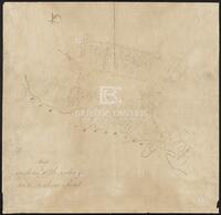
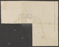
Field notes of a League of Land belonging to the Heirs of William Whiteside
-
Identifier
-
camh-dob-013690
-
Creator
-
Austin, Stephen F. (Stephen Fuller), 1793-1836
-
Dates
-
1830
-
Resource
-
Stephen F. Austin map collection
-
Description
-
Field notes and sketch of a League of land belonging to the heirs of William Whiteside in Waller County along the Brazos River. Two separated pages.
-
-
Title
-
Map of Austin's Little Colony above San Antonio Road
-
Identifier
-
camh-dob-013691
-
Creator
-
Austin, Stephen F. (Stephen Fuller), 1793-1836
-
Dates
-
1830
-
Resource
-
Stephen F. Austin map collection
-
Description
-
Sketch of plats of Austin's Little Colony above the Colorado River and San Antonio Road. Contains names and measurements of land allotted to colonists. Hand drawn. 46.5 x 44.5 cms. See Bound Collection of Title Plat Maps.
-

-
Title
-
Map of the correction when the leagues were run in to the meanders of San Jacinto
-
Identifier
-
camh-dob-013708
-
Dates
-
1830
-
Resource
-
Stephen F. Austin map collection
-
Description
-
Correcting map of plats near the San Jacinto river. 39.5 x 27 cms. Verso is inscribed with "Map of correction when The Leagues were run in to the meanders of San Jacinto."
-
-
Title
-
Map of the head waters of San Jacinto disjoined from the other surveys
-
Identifier
-
camh-dob-013711
-
Dates
-
1830
-
Resource
-
Stephen F. Austin map collection
-
Description
-
Map of plats inscribed with "This map is the head waters of San Jacinto disjoined from the other surveys. Only a connecting line runs to prove its relative situation, called upper surveys." Shows plats of Susan Vince, James Ford, and heirs of William Hodge. May be missing pieces. 39 x 35 cms. Shading in pencil.
-

-
Title
-
Plat of Land on Oyster Creek
-
Identifier
-
camh-dob-013706
-
Creator
-
Austin, Stephen F. (Stephen Fuller), 1793-1836
-
Dates
-
1830
-
Resource
-
Stephen F. Austin map collection
-
Description
-
Sketch of a plat of land on Oyster Creek in Brazoria County, showing the SFA, Grace E. Waller, and Asa Mitchell plats. 32 x 17 cms.
-

-
Title
-
Sketch of a survey in Matagorda County
-
Identifier
-
camh-dob-013713
-
Creator
-
Wightman, Elias R., 1792-1841
-
Dates
-
1830
-
Resource
-
Stephen F. Austin map collection
-
Description
-
Sketch of a survey in Matagorda County showing the plats of G.W. Cash, J. Holmes, et al, with notes. 20 x 32.2 cms. Ink with notes in pencil.
-

-
Title
-
Sketch of a survey in Matagorda County
-
Identifier
-
camh-dob-013714
-
Creator
-
Wightman, Elias R., 1792-1841
-
Dates
-
1830
-
Resource
-
Stephen F. Austin map collection
-
Description
-
Sketch of a survey in Matagorda County showing the plats of J. Homes, W. Linthequin, E. Flowers, and J. George. 20.3 x 17 cms. On verso: Same sketch, no names.
-

-
Title
-
Sketch of Joshua Hadley's Surveys
-
Identifier
-
camh-dob-013725
-
Creator
-
Williams, Samuel May, 1795-1858
-
Contributor
-
Hadley, Joshua
-
Dates
-
1830
-
Resource
-
Stephen F. Austin map collection
-
Description
-
Sketch of Joshua Hadley's surveys by Samuel May Williams. 20.3 x 24.8 cms. Verso is inscribed with "S.M. Williams Esq. Land Office Austin."
-

-
Title
-
Sketch of Labors below and above the Town Tract of San Felipe de Austin
-
Identifier
-
camh-dob-013692
-
Creator
-
Austin, Stephen F. (Stephen Fuller), 1793-1836
-
Dates
-
1830
-
Resource
-
Stephen F. Austin map collection
-
Description
-
Sketch of labors below and above the town tract of San Felipe de Austin. 45 x 57.5 cms. See Bound Collection of Title Plat Maps.
-

-
Title
-
Sketch of Matagorda Bay
-
Identifier
-
camh-dob-013693
-
Creator
-
Austin, Stephen F. (Stephen Fuller), 1793-1836
-
Dates
-
1830
-
Resource
-
Stephen F. Austin map collection
-
Description
-
Sketch of Matagorda Bay and field notes. 20.5 x 32 cms. On verso: notations of latitude and longitude.
-

-
Title
-
Sketch of plats about Chocolate Bayou?
-
Identifier
-
camh-dob-013709
-
Dates
-
1830
-
Resource
-
Stephen F. Austin map collection
-
Description
-
Sketch of plats about Chocolate Bayou? Inscribed with the word "Kentuckey" on verso. 39 x 32 cms.
-

-
Title
-
Sketch of Plats about the Colorado River in the vicinity of Cummings, Buckners, and Mills Creeks
-
Identifier
-
camh-dob-013694
-
Creator
-
Austin, Stephen F. (Stephen Fuller), 1793-1836
-
Dates
-
1830
-
Resource
-
Stephen F. Austin map collection
-
Description
-
Sketch of plats about the Colorado River in the vicinity of Cummings, Buckners, and Mills Creeks. 57.7 x 45 cms. See Bound Collection of Title Plat Maps.
-

-
Title
-
Sketch of Plats about the lower Lavaca, Navidad, and Carancahua Rivers
-
Identifier
-
camh-dob-013695
-
Creator
-
Austin, Stephen F. (Stephen Fuller), 1793-1836
-
Dates
-
1830
-
Resource
-
Stephen F. Austin map collection
-
Description
-
Sketch of plats about the lower Lavaca, Navidad, and Carancahua Rivers. 57 x 44 cms. See Bound Collection of Title Plat Maps.
-

-
Title
-
Sketch of Plats about the Rio Brazos between the Little Brazos and Navasota Rivers
-
Identifier
-
camh-dob-013696
-
Creator
-
Austin, Stephen F. (Stephen Fuller), 1793-1836
-
Dates
-
1830
-
Resource
-
Stephen F. Austin map collection
-
Description
-
Sketch of plats about the Rio Brazos between the Little Brazos and Navasota Rivers. 58 x 45 cms. See Bound Collection of Title Plat Maps.
-

-
Title
-
Sketch of Plats along the lower Colorado River and on Matagorda Island
-
Identifier
-
camh-dob-013697
-
Creator
-
Austin, Stephen F. (Stephen Fuller), 1793-1836
-
Dates
-
1830
-
Resource
-
Stephen F. Austin map collection
-
Description
-
Sketch of plats along the lower Colorado River and on Matagorda Island. Contains names and measurements of land allotted to colonists. Hand drawn. 44.2 x 57.3 cms. See Bound Collection of Title Plat Maps.
-

-
Title
-
Sketch of Plats along the lower San Jacinto River, about Buffalo and Cypress Bayou
-
Identifier
-
camh-dob-013698
-
Creator
-
Austin, Stephen F. (Stephen Fuller), 1793-1836
-
Dates
-
1830
-
Resource
-
Stephen F. Austin map collection
-
Description
-
Sketch of plats along the lower San Jacinto River, about Buffalo and Cypress Bayou. 57 x 45 cms. See Bound Collection of Title Plat Maps.
-

-
Title
-
Sketch of Plats along the Main Bernard, West Bernard, Peach Creek, and Colorado River
-
Identifier
-
camh-dob-013699
-
Creator
-
Austin, Stephen F. (Stephen Fuller), 1793-1836
-
Dates
-
1830
-
Resource
-
Stephen F. Austin map collection
-
Description
-
Sketch of plats along the Main Bernard, West Bernard, Peach Creek, and Colorado River. 44.7 x 57.6 cms. See Bound Collection of Title Plat Maps.
-

-
Title
-
Sketch of Plats along the Rio Brazos between Oyster Creek and the Rio Bernardo
-
Identifier
-
camh-dob-013700
-
Creator
-
Austin, Stephen F. (Stephen Fuller), 1793-1836
-
Dates
-
1830
-
Resource
-
Stephen F. Austin map collection
-
Description
-
Sketch of plats along the Rio Brazos between Oyster Creek and the Rio Bernardo. 45.2 x 57.3 cms. In colored outline. See Bound Collection of Title Plat Maps.
-

-
Title
-
Sketch of Plats along the Rio La Vaca and Rio Navidad
-
Identifier
-
camh-dob-013701
-
Creator
-
Austin, Stephen F. (Stephen Fuller), 1793-1836
-
Dates
-
1830
-
Resource
-
Stephen F. Austin map collection
-
Description
-
Sketch of plats along the Rio La Vaca and Rio Navidad about Upper and Lower Rocky Creeks. 45.2 x 57.8 cms. See Bound Collection of Title Plat Maps.
-

-
Title
-
Sketch of Plats along the San Antonio Road, east of the Brazos River
-
Identifier
-
camh-dob-013702
-
Creator
-
Austin, Stephen F. (Stephen Fuller), 1793-1836
-
Dates
-
1830
-
Resource
-
Stephen F. Austin map collection
-
Description
-
Sketch of plats along the San Antonio Road, east of the Brazos River. 58.3 x 45 cms. See Bound Collection of Title Plat Maps.
