- Studtman Photo Service, 19th & Lavaca, Austin (x)
- Broadside collection, Eberstadt collection (x)
- Texas History (x)
- Revillagigedo, Juan Vicente Güémez Pacheco de Padilla Horcasitas y Aguayo, conde de, 1740-1799 (x)
- Cartography (x)
- 1829 (x)
- Search results
-
-
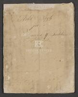
Title
-
Field Book for Surveys of Partition Work
-
Identifier
-
camh-dob-013715
-
Creator
-
Wightman, Elias R., 1792-1841
-
Dates
-
1829
1829
-
Box
-
3H241
-
Folder
-
Series V: Field Notes, books 16-37, Pamphlet - Field Notes Book 17
-
Resource
-
Stephen F. Austin map collection, Austin papers
-
Description
-
Pamphlet of survey notes and sketches of plats.
-

-
Title
-
Map of a part of DeWitt's Colony
-
Identifier
-
camh-dob-013684
-
Creator
-
Austin, Stephen F. (Stephen Fuller), 1793-1836
-
Dates
-
1829
-
Box
-
2AA1
-
Folder
-
SA 62, 1829[?]
-
Resource
-
Stephen F. Austin map collection
-
Description
-
Sketch of Colorado and Rio Grande Rivers with notes. On verso: Map of a part of DeWitt's Colony, showing the area about Gonzales, Bastrop and DeWitt's Station. 28 x 26 cms.
-

-
Title
-
Map of Texas by Stephen F. Austin
-
Identifier
-
foth_0630
-
Creator
-
Austin, Stephen F. (Stephen Fuller), 1793-1836
-
Dates
-
1829
-
Folder
-
SA 64
-
Description
-
Austin's detailed hand-drawn map showing the Austin and DeWitt colonies, various towns and rivers, and other natural features in Texas. Austin prepared the map sometime between 1823 and 1828 and based the map on firsthand observations as well as information gathered from travelers and surveyors.
-

-
Title
-
Stephen F. Austin's Map of Texas
-
Identifier
-
camh-dob-013686
-
Creator
-
Austin, Stephen F. (Stephen Fuller), 1793-1836
-
Dates
-
1829
-
Folder
-
SA 64
-
Resource
-
Stephen F. Austin map collection
-
Description
-
Map of Texas showing area between the Arkansas Territory in the north to the Mexican state of Tamaulipas in the south. Contains notes relating to the estimated population of Texan settlements as well as their general history, especially the story of how Stephen F. Austin came to settle the area. Also includes annotations relating to flora and fauna present on the land, such as buffalo, wild horses, and the prickly pear cactus. Colored outlines mark the area of Austin's colony, as well as DeWitt's colony. 66 x 81 cms. In colored outline.
